TravelCubaSite-Information, Lodging, Offerings, Classes,...
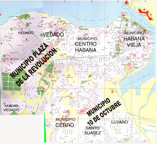
Map of Municipalities PLAZA (Vedado and Nuevo Vedado) LEFT
CENTRO HABANA and HABANA VIEJA (RIGHT-Up)
CERRO and DIEZ DE OCTUBRE (Santo Suárez and Luyanó) (RIGHT-Down)
    For go to Playas del Este using the Tunel de la Habana  


For go to Municipality Playa using 5th. Avenue Tunel that joint Malecon (in Vedado) and 5th. Ave (in Miramar) OR using  Linea Tunel  that joint Linea (in Vedado) and Calle 31 (in Playa)


For go to Municipality Plaza (Vedado and Nuevo Vedado) using "Puente Almendares" Bridge


To See Map 1 (Vedado, Nuevo Vedado and Part of Centro Habana and Cerro) To See Map 2B (part of Cerro and Diez de Octubre (Santos Suárez y Luyanó) To See Map 2A (Part of Vedado, Centro Habana and Habana Vieja)


For go to Playas del Este using  Via Blanca


Clicking on the part You decided is possible to Select the Part of the Map for after to obtain INFORMATIONS and PHOTOS

Go to Menu General
More Information about Cuba :
· Copyright © LlerySoft.com · All rights reserved · 2006 - 2019·
Author : Ing. Jorge Llerena Rodríguez. LlerySoft
blog counter