To see Map Superior Level Touristic Map of Havana CityTo see Municipalities and  Turistic Map of  Havana City To see Cuban Maps MAPA DEL MUNICIPIO BOYEROS Y ARROYO NARANJO - Idioma Español MAPPA DELLA MUNIZIPALITÉ BOYEROS E ARROYO NARANJO - Lingua Italiana LANDKARTEN VON STADTBEZIRKEN BOYEROS und ARROYO NARANJO - Deutsch Sprache
(In Municipality Boyeros) | Informations | Places |
(In Municipality Arroyo Naranjo) | Informations | Places |
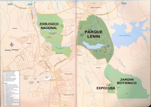
Map of Municipalities BOYEROS (International Airport José Martí) and ARROYO NARANJO (National Zoo, Lenin Park, EXPOCUBA and National Botanic Garden)
  For return to Marianao using the First Anillo (that go to Pinar del Rio) and after Calle (Street) 100 For go to Playas del Este using Primer Anillo-Monumental-Via Blanca
For go to Cerro, Nuevo Vedado, Vedado, Centro Habana and/or Habana Vieja  using  Avenida Rancho Boyeros (Avenida Independencia)


To see Map 1 (Nazional Zoo and International Airport "Jose Martí") To see Map 2 (Lenin Park, PABEXPO and National Botanic Garden)

Clicking on the part You decided is possible to Select the Part of the Map for after to obtain INFORMATIONS and PHOTOS